Saturday, September 27, 2008

Facing the fury with fragile infrastructure

I made a quick trip to Beaumont, TX, this week to check on my son and his wife. This sign is from the mall in Port Arthur. I thought it was very apropos. Hurricanes seem to be targeting population centers and infrastructure more and more.

The Materials Management Service reported this week that "52 of the 3,800 offshore oil and gas production platforms in the Gulf of Mexico had been destroyed by Hurricane Ike."

Also down for the count were three jack-up drilling rigs, and one platform drilling rig

"Initial estimates are that the 52 destroyed production platforms produced a total of 13,300 barrels of oil per day and 90 million cubic feet of gas per day."

Pipelines seemed to be a real target of the storm --

"To date, MMS has received reports of six gas transmission pipeline systems with damage. Analysis of the impact that this damage may have on resuming production is underway. Operators have begun to test and inspect other pipeline systems to evaluate the full extent of any damage. Considering the large impacted area, this will take some time to complete the inspections."

The MMS is working with operators to get passed some of the problems holding back resumption --
"Resuming Production – Production from the Gulf of Mexico accounts for 25 percent of the oil produced domestically and 15 percent of the natural gas produced domestically. ...
"Working with oil and gas operators, there are tools that can be used to assist in resuming production which is curtailed because of damaged pipelines. These tools include barging, temporary flaring, and re-routing of product through other pipelines. Use of these tools requires that offshore operators submit requests to MMS for approval."

MMS reports from yesterday estimated that approximately 59% of the oil production in the Gulf is shut-in and that approximately 56% of the natural gas production in the Gulf is shut-in.

The MMS used reports from operators to estimate that personnel are still evacuated from a total of 145 production platforms, equivalent to 20.1 % of the 694 manned platforms in the Gulf of Mexico.

If you are keeping count. That is two major energy infrastructure components that Hurricane Ike targeted severely: the electric grid and the offshore oil structures.

Strange fact of the day:

As I was driving home from Beaumont, I locked in on a Public Radio program in Louisiana that had various utility officials and emergency officials talking about what we learned from the storms. The Entergy spokesperson discussed how the electric utility plans for storms by doing mock storm drills before the start of the hurricane season.

The company which serves, among other areas, the New Orleans region and part of the Houston region, did its normal drill before the start of the 2005 season that saw Hurricane Katrina devastate the New Orleans region.

It was kind of freaky to hear that that drill, done several months before Katrina, was a scenario of a mock major hurricane hitting New Orleans.

Talk about prescience.

But it got a little more weird.

I guess based on the fact that in 2005 Hurricane Katrina was followed a month later by Hurricane Rita hitting Texas, the company this year did a mock drill of a a major hurricane followed a week later by another.

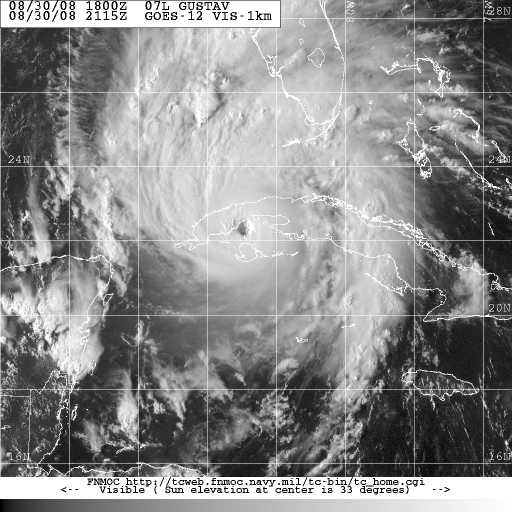
Of course that is just what happened. Hurricane Gustav sacked South Louisiana, the New Orleans region and ripped through the heart of the Louisiana as it dragged its way north. Twelve days later Hurricane Ike slammed into Houston.

A couple of observations.

1. Maybe the TV channels needs to hire Entergy to do long range forecasting.

2. We seem to be getting it right. We have a lot better understanding of hurricanes -- where they will go and the type of damage they will inflict.

Now we need to have a national dialogue on how, with better pre-hurricane planning and preparation ( including better building practices) we can spend the majority of our efforts on gettting out of the way of the storm and less on months and years of rebuilding.

How do we armor our infrastructure and our cities from these beasts?

-- steve buser


Tuesday, September 23, 2008

Monday, September 22, 2008

Can it get any worse that this?

I think there are a three kinds of people in this world.

1. Those that think that God has gone fishing and, by default, has left us to our own machinations to screw things up.

2. Those who think otherwise and that God's hand is in all of this, but stand firmly against you saying that means God caused things like two hurricanes in two weeks hitting the two most vital energy spots in the U.S.

I'll leave you to figure all of that out.

But, consider this. The blog Common Tragedies picks it as quote of the day on Sept 5 (well before Ike hit the scene). The actor is the National Strategic Petroleum Reserve which takes in oil, and deposits it in caverns in the ground that are located from near New Orleans all the way over to Houston. (well out of any hurricane alley ;-)) -- Here's the quote:

If we are going to have an emergency stockpile, it really ought to be able to function during an emergency.

"That is Mike Giberson, lamenting the fact that we cannot release oil from the SPR because the same storm that disrupted oil supply also knocked out the power needed to pump the oil."

Do you get the sense that God is throwing banana peels on our jog to be the biggest and the best? Or, do you think we are throwing them ourselves?

I mean, come on. How can one expect that two hurricanes just days apart would slice through two of our most important energy supply chains? Never happened before did it. Did it?

Oh, that? Well yes, Katrina and Rita kind of did that same thing back in 2005 but by golly that was a once in a century event.....

I hate to even add insult to injuring by rubbing in a little salt here. But within in a span of less that a month, two hurricanes crippling our energy supply then this incredible melt down on the credit markets and a proposed $700 million bailout by a Republican president? What's the odds of that all happening?

I suppose that's the absolute worse that can happen in the way of cataclysmic events coming together at one time, right? It can't get any worse that this, can it? Can it?

I believe it can. I would like to lumber through some thoughts on that in the next few days.

Hope you will join me. I invite you comments.

Oh, yes.

3. Those that believe that God has a plan and it includes us being smart enough to solve by ourselves some of the screwballs this world is throwing at us.

Next time, bring a cup of coffee. We have some talking to do.

--steve buser

Some reading:

Shell hopes to reroute Auger pipeline in US Gulf
...Nearly 80 percent of the Gulf of Mexico's 1.3 million bpd of crude and 65 percent of its 7.4 billion cubic feet per day of natural gas remains shut in the wake of Hurricane Ike.


Williams Provides Update on Gulf Coast Operations Following Hurricanes
...The Cameron Meadows natural gas processing plant, located near the communities of Cameron and Johnson Bayou, La., sustained significant damage from Hurricane Ike and is currently shut down. The facility will require repairs, but the extent and timing are still being assessed.

New York crude oil soars record 16.37 dollars
...This month, every OSV that can work is working. Vessel owners surveyed this month said 207 vessels are working, and fleet utilization is effectively 100 percent. Operators need more vessels, but can't find them. One owner told EnergyCurrent, "We could use 10 more boats."

Damage from Ike could affect coastal ecosystem of Texas for years
...I'm sure what we'll see (from Ike) is more evidence of what happens when we don't maintain those natural barriers," said Larry McKinney, executive director of the Harte Research Institute for Gulf of Mexico studies at Texas A&M University-Corpus Christi.

When the oil stops flowing
...Exactly how could America be subjected to a protracted oil interruption, that is, a 10% shortfall lasting longer than several weeks? It will not come from hurricane action in the Gulf of Mexico, or even major refinery accidents or other oil infrastructure damage.

Ike's littered past still haunts

Some new photos of the devastation of Hurricane Ike. Top is a Coast Guard Photo --notice the helicopter flying over the flooded area on Galveston

This next photo (above) is a sand left over from Ike, hiding a road on the Bolivar peninsula.
The line of trucks heading through the flood waters is from Entergy (the electric company) site. Thas a heroic rescue of millions of dollars in trucks and equipment as the flood waters started to inundate the lower areas of Louisiana' coast. The trucks were working on repairs from Hurricane Gustav, when Hurricane Ike's winds and waves were about to catch them.

Another FEMA photo of the seawall and the debris washed up on what little is left of the beach in Galveston.
Another photo from Entergy's site showing the time of power line damage the company had to deal with from damages by two strong hurricanes in two weeks . (We won't even mention Tropical Storm Faye. ) The damages were all across Entergy's Louisiana, Texas, and Arkansas service areas. Check this site which shows the places were power is still not available (though the numbers are dwindling).

Below is screen shot of the Entergy Outage screen from Beaumont, Texas. Each shape is clickable and gives a report on the outage as well as how many customers are affected. This is best and most useful online map mashup I have ever scene. Customer service has taken a giant leap.


--steve buser

Saturday, September 20, 2008

Hurricane Ike -- after the storm

Seems some areas fare a comparative "well" from Ike's fury. This is an aerial photo of the Golden Pass LNG project under construction in Sabine Pass, TX. There seems little out of place in the photo and no obvious damages such as missing roof on the large tanks or levees washed out.

The photo is from a series of satellite shots indexed by NOAA-- you click on the area you want to see and when the image comes up, click it to see a zoomed in view. These are very large files -- this file is just a piece of one and I reduced it to 33% of its size to keep the file size here manageable (click on the photo for a close up view).

Below is a shot of the Port of Port Arthur -- notice no trains, no trucks -- the mandatory evacuation order was in place when these pictures were shot. Also, notice the roof damage on the warehouse on the left.


Some followup on Hurricane Ike's after math.

Google Maps file that shows aftermath all along the Texas -- Louisiana coast (view in Google maps or download to view in Google earth)

New York Times, video of first rescuers view of Bolivar Peninsula near Houston

AP followup video of Houston after Ike (YouTube.com)

Dallas TV Station photos of Ike devastation

USGS compares before and after shots of Bolivar, Sabine Pass, Galveston and more.

-steve buser

Friday, September 12, 2008

Going into the eye of Ike


This is what it looks like when a weather buoy goes into the eye -- winds go up, air temperature and pressure drop dramatically. Unfortunately, that may have been the end of this buoy -- it had not reported for more than 2 hours after these readings.

This buoy is (maybe was) about 123 miles southeast of Galveston, about 13 miles from the 4 p.m. position of the Gulf-eating Hurricane.

-steve buser

Hurricane Ike blowing ashore near Galveston in Texas

The chart above shows the windspeed at the National Buoy Data Center's buoy on the Jetty at Galveston Bay. Galveston is the island that seaward of Houston.. The winds were just shy of 40 knots just after 4 p.m.

The picture below is a satellite view of Hurricane Ike about the same time. The storm is different from other storms in that the eye is not clearly visible and is not tightly compact.
Scientist will have a long time to study that and find out why. One immediate impact if it holds up like that when Ike's eye hits land -- at 12 mph, some people will be in the eye 4 or 5 hours.

Below the satellite photo is a graph showing how fast the barometric pressure is falling as Ike approaches


--steve buser

Mighty Ike expected to mess with Texas

This is the latest view of Hurricane Ike from NASA's Global Climate and Hydrology Center.

I have marked New Orleans (where I am) and Houston (the apparent landfill target -- and where I am glad I am not.)

Our thoughts and prayers are with those in Houston and the surrounding area. Notice the eye which has opened up in the center of Ike -- that had not be visible yesterday -- he seems to be getting better organized. Fortunately, weather forecasters say there are lot of things keeping Ike from organizing up to a Category 4 or 5 storm (wind shear, dry air wrapping in to the swirl periodically, etc). Ike is expected to be a Category 2 or 3 storm when it pushes as much of the Gulf as it can control up over the beaches of Galveston later tonight.

-steve buser

Ike lets his presence be known

The low clouds that capture the reflection of the city lightswere whisking past yesterday at sundown, helping the moon to play peekaboo.

Hurricane Ike was sending out its tentacles as in thrashed around in the middle of the Gulf of Mexico passing us by.

That's not to say he didn't leave scars here. There were evacuations and flooding in the areas down close to the Gulf of Mexico. There were starting to be power outages in the New Orleans area -- people who had just returned and had their power restored, were now in the dark again.
In the cities of our region closesto the Gulf that suffered the most from Hurricane they were expected hurricane force winds or near hurricane force winds from Ike's brush by.

I took this picture out on the levee near where the 23 mile Causeway bridge comes ashore in Metairie from its span of Lake Pontchartrain. You can see these building rise up in the sky as you are coming across the Causeway from the north shore.

--steve buser

Thursday, September 11, 2008

Houston target for Hurricane Ike?

The newest storm advisory from the National Hurricane Center slides the center of the forecast path up the coast to near or over Houston

Hurricane Ike Models in Google Earth


Here is the National Weather Service's KMZ file for the forecast Models of Hurricane Ike.

Download the file and open it in Google Earth.

Enjoy.... or, sweat.

Hurricane Ike splashing and spitting in Gulf

The buoy in the Gulf south of Dauphin Island, AL is giving us a good picture of the power of Hurricane Ike more than 200 miles away from it. The photo shows the wind speed and below are the readings (both at 8:50 a.m. CDT) Info from the National Data Buoy Center of NOAA.

5-day plot - Wind SpeedWind Speed (WSPD): 29.1 kts
5-day plot - Wind GustWind Gust (GST): 36.9 kts
5-day plot - Wave HeightWave Height (WVHT): 24.9 ft


--steve buser

Quick action needed for Hurricane Ike

Massive evacuations are taking place along much of the Texas Coast as Hurricane Ike is just two days away from predicted landfall.

One thing I have found out. This storm is too massive. The effects too widespread for me to keep up with. I first started this site to try to chronicle layman's view as it pushed its way toward New Orleans. I got carried away with the track and meteorolgy of it.

I have listed several news sites on the right hand column. I urge you if you are along the Gulf Coast to turn on your TV, your radio or your internet and get accurate local information about the effects this storm will have on your location. You don't have much time to take appropriate action.

Indeed in the New Orleans area we are already under a tropical storm warning even though forecasted land fall for the storm will be more than 300 miles away. (see the NOAAWatch.gov map of warnings along the Gulf Coast for Hurricane Ike)

WeatherUnderground.com is showing our area can expect a 6 to 9 foot surge. The rain at my place has just started falling and it sounds like large drops on the windows. We will have strong and gusty winds today and tomorrow.

If you live in low lying areas, please find out what the storm surge will be in your area. You have little time to take action.

--steve buser

Wednesday, September 10, 2008

Ike keeps the whole Gulf Coast in the game


Image -- how Hurricanes are "won." FEMA Photo by Barry Bahler

The National Weather Service says
"AT 700 PM CDT...0000Z...
THE CENTER OF HURRICANE IKE
WAS LOCATED NEAR
LATITUDE 24.7 NORTH...LONGITUDE 86.3 WEST
OR ABOUT 700 MILES...1125 KM...
EAST OF BROWNSVILLE TEXAS
AND ABOUT 345 MILES...555 KM...
SOUTH-SOUTHEAST OF
THE MOUTH OF THE MISSISSIPPI RIVER.

IKE IS MOVING TOWARD THE NORTHWEST
NEAR 8 MPH...13 KM/HR.... "
"DATA FROM A NOAA HURRICANE HUNTER
AIRCRAFT INDICATE THAT
MAXIMUM SUSTAINED WINDS
REMAIN NEAR 100 MPH...160 KM/HR"

(Photo Left from NOAA Satellite and Information Service showing how Ike is swallowing the Gulf.)


Commentary
Is Hurricane Ike teasing Louisiana?

I know it sounds preposterous but what else can it be? The National Weather Service has laid out a track for Ike to hit Texas, first at the Mexico line and then later near Corpus, and now a little farther up that coast than that. But Ike just seems determined to make a close pass, like some long ago Moon shot, just south of Louisiana.

And it seems to be taking its time doing it. I mean, 7 miles per hour. That's a turtle race. Big strong storms are suppose to power across the ocean. And northwest? What's that all about. The storm is suppose to go west north west ( the two west do make a left turn) and that will keep it away from Louisiana.

All the science, the years of pondering and filing through rows of numbers and equations and matching them to past storms. Our best scientists and best mathematicians and technicians and physicist and theorist -- all the kings horse and all the kings men can't make Ike do what science says he should do.

Makes us seem kind of small in the scheme of things. Powerless against vast powers of self-inspired nature We are fle as on ancharging elephant-- pulling back to stop him.

But Ike will turn. It will turn because all across the Gulf Coast people are staying up for the 10 0'clock news -- one last hope against hope that our team got it right, called the right play, had the right players in the game, sco uted the opponents the best.

Of course in Texas, they are pulling against the legions of number crunchers and weather watchers. I am sure they have more prayers on their side. The mathaticos and nature wizards have left them to the wind. They have to call on the eternal. It is their only stand. Surely they got the weatherati got it wrong. Surely the trough (whatever that really is) will sweep down, deus ex machina, and whisk this beast back to the east and spare them.

So here we are like two stands of cheering supporters. Louisiana pulling for the scientists behind the grand shimmering curtain ... Texans pulling for a thundering trough that will rumble in like Helios on his golden chariot pulled by teams of mighty galloping steeds.

We cheer. We cajole. We yell encouragement. We even pray. But in the end, all along the Gulf Coast, we are just spectators in the stands, watching a game of strength among the gods: a game that will spill out of the watery playing field and into our bleachers -- this side or that, us or them. Then we will become engulfed in the game, scurrying to keep from getting hurt.

We pray for each other, promise help if our neighbors get trampled. But, our biggest hope is that we get left out of the real blood sport. The mixing of billions of gigawatts of twisting mists and groaning winds with solid but vulnerable structures and plants and pets and human lives. Like some universal scrum --forces pushing against forces so strong that mists become deadly weapons.

The only way the spectators can win is to guess right about whether it will be their bleachers which will become the battlefield and then get out of the way before they do.

That is our game.

Not knowing where the game will spill out of the Gulf and onto land, and having only a few precious hours, we have to get millions of souls out of the way. We have to fortify our homes and latch down movable things. We scurry pets to safety. Gently move our sick and elderly. We overload highways, runways, railways and anthing else that moves. And leave behind ghost towns. The Poseidon may spring up as a watery warrior to usurp Zeus's kingdom. But we leave hims a Pyrrhic victory. Whatever he claims, can be rebuilt.

The hurricane is an event that shows us what we are made of. Each one of us. And all of us. We find that we can work together better than ever before pressed by impossible deadlines. Or we find out that old wounds cannot be bandaged that quickly and we fail in our cause. It is ours to lose.

In the end lives are at stake. Property damage will be counted in billions of dollars. Lives will be counted as tears.

We're in this together.

--steve buser

Brave Helios, wake up your steeds...
Fema Photo by Michael Rieger

Ike staring down Texas' barrel

The National Hurricane center says Hurricane Ike, a Category 2 storm with 100 mph winds, now officially has the Texas Coast line in its 3-day cone of uncertainty, though Ike is continuing to drag along at 8 mph in a northwest direction. I know this has a lot of people in Texas scrambling, not the least of which is Galveston and Houston which take a lot of time to evacuate.

(photo on the left is a FEMA photo of evacuation buses at a staging area in Beeville, ready to roll)

The NOAA Satellite and Information Service has out a new high resolution picture showing Ike setting up its spidery swirl across the entire Gulf of Mexico.

News notes:

Evacuation buses moving south of Houston

President declares emergency in Texas

School closings in Houston area

City of Corpus Christi Hurricane Site

Corpus Christi closures due to Ike

--steve buser

Hurricane Ike demands attention


Pictures starting to flow in from the destruction in the Caribean -- these Haiti pictures are by
Radio Nederland Wereldomroep on Flickr.com

Some the headlines developing:

Up-to-date changes and cancellations in Corpus Christi (Caller Times)

Navy shifts personnel in advance of Ike. Corpus Christi (Caller Times)

The pre-storm hotel rush is on Corpus Christi (Caller Times)

Evacuation of coastal residents ordered near Houston -- Houston Chronicle


The Material Management Service which overseas U.S. interest in oil and gas drilling said yesterday "personnel have been evacuated from a total of 167 production platforms, equivalent to 23.3 % of the 717 manned platforms in the Gulf of Mexico. Production platforms are the structures located offshore from which oil and natural gas are produced. These structures remain in the same location throughout a project’s duration unlike drilling rigs which typically move from location to location. "

The service added "
Personnel from 44 rigs have also been evacuated; this is equivalent to 36.4 % of the 121 rigs currently operating in the Gulf. Rigs caninclude several types of self-contained offshore drilling facilitiesincluding jackups, submersibles and semisubmersibles.

From the operators’ reports, it is estimated that approximately 77.5% of the oil production in the Gulf has been shut-in. Estimated current oil production from the Gulf of Mexico is 1.3 millionbarrels of oil per day. It is also estimated that approximately 64.8% of the natural gas production in the Gulf has been shut-in. ..."

-steve buser

Hurricane Ike laying claim on Gulf of Mexico

It is still there!

Hurricane Ike didn't disappear last night.

In fact, it start spinning up the Gulf of Mexico and claiming it as its own.

I start the day out with a new graphic -- looks familiar doesn't it? The difference is there is no track down the center. I'm wondering if this is not a more accurate representation of what we know. Hurricanes rarely follow the line down the middle, but they do often stay within the cone of uncertainty. This gives a better picture to me of who ought to be taking serious preparations at this time.

Just a thought.

Click on the graphic above from the National Hurricane Center to get all the coordinates and such. A couple of things caught my attention:
  • the storm turned to a NW heading over night -- which if it holds up will take it more into the center of the Gulf
  • the storm has slowed down to 8 mph. Seems to me, the faster it moves, that harder it is for it to take sharp turns.
  • Winds are picking up -- 85 mph now.

You want to see how big this thing is getting, view this NOAA hi-res shot.

You can still see the storm pretty good on the Casablanca, Cuba radar, which to me is amazing considering the hit the upper end of Cuba took and continues to take.

--steve buser


Tuesday, September 9, 2008

Hurricane Ike pounces into Gulf of Mexico

Ike is a Gulf Coast hurricane. It is official. Wish it weren't but it is.

That sends shivers up the spines of people along the Gulf Coast. Especially along the middle Texas coast which is now the center of the cone of uncertainty. Maybe they should be rejoicing, though. As local forecaster Bob Breck noted tonight, with the way these forecast go, this far out, being the target is a safe place. The original target was up the East Coast of Florida,
  • then the west coast of Florida,
  • then the panhandle,
  • then New Orleans,
  • then the Upper Texas Coast,
  • then the Mexican border area,
  • then they moved it back up to middle coast of Texas.
He was just joking, of course, but, it does strike a chord. If you want to see what I am talking about, check out this animation of the predicted track for Tropical Storm Fay and watch how it changes over time.

Whoops. I almost forgot, you want to know about the numbers for the storm. Here's from the 9 p.m CDT National Hurricane Center advisory.

---------------------------
"THE CENTER OF HURRICANE IKE
WAS LOCATED NEAR
LATITUDE 23.2 NORTH...LONGITUDE 84.3 WEST
OR ABOUT 120 MILES...
195 KM...WEST OF HAVANA CUBA.

IKE IS MOVING TOWARD THE
WEST-NORTHWEST NEAR 9 MPH...15 KM/HR
..AND THIS GENERAL MOTION IS EXPECTED
TO CONTINUE FOR THE NEXT DAY OR TWO."
-------------------------

Winds are still 80 mph, but a clear eye wall is appearing and forecaster expect it to develop into a category 2 or 3 storm quickly.

(Notice that the speed has dropped to around 9 mph. That could play a role in where landfall happens. The longer it takes to hit land, the longer the atmosphere has to mess up the NHC predictions.)

--steve buser

Strange coincidence -- 11 days apart, same place

If you are one of those people who like strange coincidences, you're are going to LOVE this one: (picture above is Hurricane Ike below is Gustav)

1. Hurricane Ike's latest advisory
AT 200 PM EDT...1800Z...
THE CENTER OF HURRICANE IKE
WAS LOCATED INLAND OVER WESTERN CUBA NEAR
LATITUDE 22.7 NORTH...
LONGITUDE 83.4 WEST


OR ABOUT 65 MILES...105 KM...
WEST-SOUTHWEST OF HAVANA CUBA.

2. Hurricane Gustav's advisory
from 11 days ago --
AT 800 PM EDT...0000Z...
THE EYE OF HURRICANE
GUSTAV WAS LOCATED
NEAR
LATITUDE 22.7 NORTH...
LONGITUDE 83.4 WEST
.
THIS POSITION IS
OVER WESTERN CUBA NEAR
LOS PALACIOS

AND ABOUT 65 MILES...105 KM...
WEST-SOUTHWEST OF HAVANA.

Same place over Cuba. Same coordinates.

Of course, the predicted tracts are totally different and Gustav's winds were at 150 mph, making Ike's 80 mph winds seem weak.

The picture of Gustav on the left was from a few hours before it reached the place we are talking about here. I just couldn't find an archive shot at exactly the right hour

-- steve buser

Texas media starting to ramp up Hurricane Ike news

This buoy off Sand Key, FL is reporting winds of 54kts out of the east south east, showing the Florida keys will be getting some strong effects for Hurricane Ike as it passes by the dangling state. The best real time site to watch Hurricane Ike, right now, is the radar at Casablanca, Cuba.

Meanwhile, the weather news is picking up in the Houston area after yesterdays the oil companies sprang to action:

Oil, gas companies do it all over again

here's the Houston Chronicle's Hurricane Central

Corpus Christi's Caller Times is paying close attention to Hurricane Ike

The Brownsville Herald is also keeping track of where the storm will be targeting in the lower Texas coast

Even the Beaumont Enterprise on the the upper Texas coast reports events beginning to be cancelled in anticipation of the weather events to come.

--steve buser
The newest high resolution satellite picture of Ike is out showing Hurricane Ike pushing bands out way across the Gulf of Mexico, even while it finishes ravishing Cuba.

The latest coordinate put the storm over land on the Northwest end of Cuba, probably it's last landfall before spilling into the Gulf. It is a much slower, weaker storm, but still well organized.

It has maintained it's 13 mph forward speed but winds are listed at a generous 80 mph.

While the Louisiana coast is no longer in the cone of uncertainty, predictions show about a 20 to 40% chance the New Orleans region could see tropical storm force winds in the middle of the week.


--steve buser

Hurricane Ike seems to like lower Texas coast

The New Orleans Region is out!

The new model runs set the sites of Hurricane Ike on the lower Texas coast and Louisiana's coast line including the New Orleans region is no longer in the cone of uncertainty.

The storm is having a tough time with the Cuban coastline as it pushes its way through the Golfo de Matamano.

It is aiming over the Sierra de la Guira -- a favorite bird watching area and preserve with pine, cedar and mahogany forests. It will apparently pass almost directly over San Diego de la Banos.

You can watch its progress on this radar on the Isle of Pines, just across the bay from the center of the storm. Or from Casblanca, Cuba radar which shows the lower Florida coast which is getting bands from the storm as it passes by.

Of course, the National Weather Service radar in Miami gives the same view from the U.S. side.

--steve buser

Monday, September 8, 2008

Hurricane Ike losing strength strafing Cuba shores


Old Hurricane Ike is still sliding along the Cuban coast and losing strength doing it.

At 10 p.m. our time the center of Hurricane Ike was located near latitude 21.8N longitude 80.8W -- in the Gulfo de Cazones, 2o miles south of Playa Giron and Bahía del Cochinos (Bay of Pigs) on the south coast of Cuba 140 miles southeast of Havana. Sustained winds are at a 80 mph maximum and forward speed slipped slightly to 13 mph.

The storm was ravelled by its pass over Cuba even though it escaped the highest mountains. Central pressure has risen to 967 milibars and hurricane force winds now only extend 35 miles from the center.

For your historical interest, the Bay of Pigs was the site of a 1961 U.S.-backed invasion by 1200 Cuban exiles and supporters that failed to overthrow President Fidel Castro's government. The survivors were later traded to the US for $53 million in medicine and money.

On its way toward this spot Ike's center passed just to the south of the city of Cienfuegos --one of Cuba's chief seaports (center of sugar trade, coffee and and tobacco) the farming region around Cienfuegos (literally 100 fires) is a chief sugar cane and coffee growing region. ( I can see a story coming about this effect on the world market because of the effect of Gustav on US sugar cane crops).

The picture above is the the state hotel in Cienfuegos. (Photo by Dirk van der Made)

Below, the picture is of a beach on the island of Cargo Largo del Sur -- on the south edge of the Gulfo de Cazones where Hurricane Ike is now passing.

--steve buser

Quick Hurricane Ike update.

Key West Radar is starting to pick up the outer bands of Hurricane Ike.


Here is the latest wave height predictions that show the path of Hurricane Ike through the Gulf of Mexico.

--steve buser

Ike slides along Cuban coast -- Texas is the bullseye


The new Hurricane Ike path from NOAA keeps New Orleans just on the edge of the cone of error. The Central Texas Coast is in the center. This puts a real burden on the Houston and Corpus Christi areas to keep and eye on the storm but pushes back likely landfall to Saturday.

Cuba is also taking its toll on the storm with the maximum sustained winds down to 85 mph.

Weather in the Keys
The winds are starting to pick up in the Florida Keys with the Sombrero Key buoy reporting 28kt sustained winds and long key reporting 22kt winds. Sand Key, the furthest buoy on the strand out from the mainland is reporting 31kts winds.

Real Time Buoy data
Here's some real time buoy data from the west side of the storm.

--steve buser

Hurricane Ike slides back into hot water

Hurricane Ike has been holding steady at about the 2.1 latitude mark for the past 24 hours. For that matter it is has basically been on that track for several days. That is a direct west heading.

The forecast calls for a turn slightly to the north to follow Cuba. It is not out of the realm now that it will go along Cuba's south shore over the water. It went in a straight diagonal path west across Cuba, hitting the third largest city Camaguey, a large dairy center , where the radar is now out of service.

It has emerged into a shallow coastal bay that is protected by barrier islands. The latest National Hurricane Center Advisory still has it as a category 2 storm with 100 miles per hour winds and heading due west at 14 mph. It expects it to slide up the Cuba, now though, much of that sliding may be over open water (of sorts).

Though, Camaguey radar is out, you can still track the storm with the Pico de San Juan radar from Cuba.

You can now watch the storm approaching (in about 36 hours) from a Key West, Florida beach cam. And this cam at Mallory Square

Governor Bobby Jindal declares emergency for Louisiana as Ike approaches


Here's NOAA's latest high resolution picture of Ike just crossing Cuba


Hurricane Ike gathering headlines on trek toward Gulf of Mexico

Fema evacuees return to New Orleans from their shelters for Hurricane Gustav, only to greet the possibility of Hurricane Ike emerging into the Gulf (FEMA photo by Barry Bahler)


Some miscellaneous news of interest to Hurricane Ike watchers.


President declares emergency for Florida in advance of Ike

Corps starts Blue Roof Program in Louisiana for Hurricane Gustav damaged homes

Disaster Recovery Center Opens in Houma to Assist Residents

Ike Slams Cuba, Keys Could Be Next (Channel 13 Central Florida)

Hurricane Ike
slams Cuba, Haiti death toll passes 600
(AFP)

Entergy restores 80 percent from Gustav; awaits Ike
(Beaumont, TX Enterprise)

Hurricane Ike sweeps across lower Cuba

Hurricane Ike appears ready to emerge back over water after cutting across the middle third of Cuba during the night.

Wide satellite imagery shows outflow bands from Hurricane Ike beginning to sweep across southern Florida.

The 7 am CDT advisory from the National Hurricane center puts the center of Hurricane Ike at Latitude 21.1 North and Longitude 77.9 West -- 20 miles directly south of Camaquey, Cuba's third largest city. It is moving west near 14 mph and a west to west-northwest motion is expected over the next day or two. "

"On this track the center of Ike will move over or very near central Cuba today ... and
emerge into the Southeastern Gulf of Mexico by late Tuesday."

MAXIMUM SUSTAINED WINDS HAVE DECREASED TO NEAR 100 MPH...155
KM/HR...WITH HIGHER GUSTS. IKE IS A CATEGORY TWO HURRICANE ON THE
SAFFIR-SIMPSON SCALE. ADDITIONAL WEAKENING IS FORECAST AS IKE MOVES
OVER CENTRAL CUBA TODAY.

HURRICANE FORCE WINDS EXTEND OUTWARD UP TO 60 MILES...95 KM...FROM
THE CENTER...AND TROPICAL STORM FORCE WINDS EXTEND OUTWARD UP TO 200
MILES...325 KM. THE ESTIMATED MINIMUM CENTRAL PRESSURE IS 960 MB...28.35 INCHES.

Hurricane Ike makes landfall in Cuba

The latest prediction by NOAA and the National Weather Service puts Hurricane Ike in the center of the Gulf this Thursday night with a brush past New Orleans and a bead on the upper Texas Coast. The cone of error however is still quite large extending from Pensacola to the Brownsville, TX.

Meanwhile, Hurricane Ike made is second landfall, this time in Cuba near the town of Puerto Padre. (Weather Underground's page for Puerto Padre)

Camagüey, the third largest city of Cuba with a population of 324,921 seems to be the next largest city in the path of Hurricane Ike.

The photo of Camagüey on the left (photo by Danelo) shows Iglesia San Francisco (right) and Estadio Cándido González (background, center)

Camagüey Radar

Pico de San Juan Radar

--steve buser


Salient parts of the 2:oo a.m EDT ( 1:oo a.m. here) :
TNT34 KNHC 080555
TCPAT4
BULLETIN
HURRICANE IKE INTERMEDIATE ADVISORY NUMBER 28A
NWS TPC/NATIONAL HURRICANE CENTER MIAMI FL AL092008
200 AM EDT MON SEP 08 2008

...IKE JUST INLAND OVER EASTERN CUBA...

....

A HURRICANE WARNING REMAINS IN EFFECT FOR THE CUBA FROM THE PROVINCE OF GUANTANAMO WESTWARD THROUGH MATANZAS. PREPARATIONS TO PROTECT LIFE AND PROPERTY SHOULD BE RUSHED TO COMPLETION.

A HURRICANE WATCH IS IN EFFECT FOR THE CUBAN PROVINCES OF LA HABANA...CIUDAD DE HABANA...PINAR DEL RIO...AND THE ISLE OF YOUTH.

A HURRICANE WATCH IS IN EFFECT FOR THE FLORIDA KEYS FROM OCEAN REEF WESTWARD...INCLUDING THE DRY TORTUGAS.

A TROPICAL STORM WATCH REMAINS IN EFFECT FOR JAMAICA AND THE CAYMAN ISLANDS.

ALL INTERESTS IN THE NORTHWEST BAHAMAS AND SOUTH FLORIDA SHOULD CLOSELY MONITOR THE PROGRESS OF THIS HURRICANE.

FOR STORM INFORMATION SPECIFIC TO YOUR AREA...INCLUDING POSSIBLE INLAND WATCHES AND WARNINGS...PLEASE MONITOR PRODUCTS ISSUED BY YOUR LOCAL WEATHER OFFICE.

AT 200 AM EDT...0600Z...THE CENTER OF HURRICANE IKE WAS LOCATED NEAR LATITUDE 21.2 NORTH...LONGITUDE 76.6 WEST OR JUST INLAND NEAR THE THE NORTH COAST OF EASTERN CUBA IN THE PROVINCE OF LAS TUNAS. THIS POSITION IS 85 MILES...135 KM...EAST OF CAMAGUEY.

IKE IS MOVING TOWARD THE WEST NEAR 14 MPH...23 KM/HR...AND A WEST TO WEST-NORTHWEST MOTION IS EXPECTED OVER THE NEXT DAY OR TWO. ON THIS TRACK THE CENTER OF IKE WILL MOVE OVER MUCH OF CENTRAL CUBA TODAY...AND BE NEAR OR OVER WESTERN CUBA ON TUESDAY.

MAXIMUM SUSTAINED WINDS ARE NEAR 120 MPH...195 KM/HR...WITH HIGHER GUSTS. IKE IS A CATEGORY THREE HURRICANE ON THE SAFFIR-SIMPSON SCALE. WEAKENING IS LIKELY AS IKE MOVES OVER CUBA DURING THE NEXT DAY OR SO.

HURRICANE FORCE WINDS EXTEND OUTWARD UP TO 60 MILES...95 KM...FROM THE CENTER...AND TROPICAL STORM FORCE WINDS EXTEND OUTWARD UP TO 140 MILES...220 KM.

ESTIMATED MINIMUM CENTRAL PRESSURE IS 945 MB...27.91 INCHES.

STORM SURGE FLOODING OF 9 TO 12 FEET ABOVE NORMAL TIDE LEVELS... ALONG WITH LARGE AND DANGEROUS BATTERING WAVES...CAN BE EXPECTED WITHIN THE WARNING AREA IN AREAS OF ONSHORE WINDS.

LARGE SWELLS GENERATED BY IKE WILL AFFECT PORTIONS OF THE SOUTHEAST UNITED STATES COAST DURING THE NEXT COUPLE OF DAYS. THESE WAVES COULD GENERATE DANGEROUS AND LIFE-THREATENING RIP CURRENTS.

IKE IS EXPECTED TO PRODUCE RAINFALL ACCUMULATIONS OF 6 TO 12 INCHES OVER EASTERN AND CENTRAL CUBA...WITH ISOLATED MAXIMUM AMOUNTS OF UP TO 20 INCHES POSSIBLE. THESE RAINS ARE LIKELY TO CAUSE LIFE- THREATENING FLASH FLOODS AND MUD SLIDES OVER MOUNTAINOUS TERRAIN. RAINFALL TOTALS OF 4 TO 8 INCHES ARE POSSIBLE IN THE SOUTHERN
BAHAMAS. PORTIONS OF HISPANIOLA COULD RECEIVE ADDITIONAL AMOUNTS OF 3 TO 5 INCHES. ADDITIONAL RAINFALL AMOUNTS OF 2 TO 4 INCHES ARE POSSIBLE OVER THE TURKS AND CAICOS ISLANDS. RAINFALL ACCUMULATIONS OF 1 TO 3 INCHES ARE POSSIBLE OVER THE FLORIDA KEYS.
...

$$
FORECASTER FRANKLIN

Sunday, September 7, 2008

Hurricane Ike jogs to west?

The latest Satellite loop for Hurricane Ike shows it changing directions to the west and apparently staying off the coast of Cuba for a while. That could be a spoiler for the theory that travelling over the length of Cuba will weaken Ike.


The latest advisory on the storm from the National Hurricane Center:
WTNT34 KNHC 071801
TCPAT4
BULLETIN
HURRICANE IKE INTERMEDIATE ADVISORY NUMBER 26A...CORRECTED
NWS TPC/NATIONAL HURRICANE CENTER MIAMI FL AL092008
200 PM EDT SUN SEP 07 2008

...CORRECTED FOR TIME...

...EYE OF IKE JUST WEST OF GREAT INAGUA ISLAND...

A HURRICANE WARNING REMAINS IN EFFECT FOR THE TURKS AND CAICOS
ISLANDS AND THE SOUTHEASTERN BAHAMAS INCLUDING THE ACKLINS...
CROOKED ISLAND...THE INAGUAS...MAYAGUANA...AND THE RAGGED
ISLANDS...AND FOR THE CENTRAL BAHAMAS INCLUDING CAT ISLAND...THE
EXUMAS...LONG ISLAND...RUM CAY...AND SAN SALVADOR.

A HURRICANE WARNING IS IN EFFECT FOR THE CUBAN PROVINCES OF VILLA
CLARA...SANCTI SPIRITUS...AND CIENFUEGOS. A HURRICANE WARNING IS
NOW IN EFFECT FOR THE CUBAN PROVINCES OF GUANTANAMO...SANTIAGO DE
CUBA... HOLGUIN...LAS TUNAS AND GRANMA...CAMAGUEY...CIEGO DE
AVILA....VILLA CLARA...SANCTI SPIRITUS...AND CIENFUEGOS. A
HURRICANE WARNING MEANS THAT HURRICANE CONDITIONS ARE EXPECTED
WITHIN THE WARNING AREA WITHIN THE NEXT 24 HOURS. PREPARATIONS TO
PROTECT LIFE AND PROPERTY SHOULD BE RUSHED TO COMPLETION.

A HURRICANE WATCH IS IN EFFECT FOR THE CUBAN PROVINCES OF
MATANZAS...LA HABANA...AND CIUDAD DE HABANA. A HURRICANE WATCH
MEANS THAT HURRICANE CONDITIONS ARE POSSIBLE WITHIN THE WATCH
AREA...GENERALLY WITHIN 36 HOURS.

A HURRICANE WATCH IS IN EFFECT FOR THE FLORIDA KEYS FROM OCEAN REEF
SOUTHWARD...INCLUDING THE DRY TORTUGAS.

A HURRICANE WATCH REMAINS IN EFFECT FOR ANDROS ISLAND IN THE
BAHAMAS.

A TROPICAL STORM WARNING IS IN EFFECT FOR THE NORTHERN
PENINSULA OF HAITI FROM THE NORTHERN BOARDER WITH THE DOMINICAN
REPUBLIC TO GONAIVES.

A TROPICAL STORM WATCH REMAINS IN EFFECT FOR THE CAYMAN ISLANDS.

ALL INTERESTS IN THE REMAINDER OF THE BAHAMAS...CUBA...AND SOUTH
FLORIDA SHOULD CLOSELY MONITOR THE PROGRESS OF THIS POTENTIALLY
DANGEROUS HURRICANE.

FOR STORM INFORMATION SPECIFIC TO YOUR AREA...INCLUDING POSSIBLE
INLAND WATCHES AND WARNINGS...PLEASE MONITOR PRODUCTS ISSUED
BY YOUR LOCAL WEATHER OFFICE.

AT 200 PM EDT...1800Z...THE CENTER OF HURRICANE IKE WAS LOCATED
NEAR LATITUDE 20.9 NORTH...LONGITUDE 74.0 WEST OR JUST WEST OF GREAT
INAGUA ISLAND AND ABOUT 90 MILES...155 KM...EAST-NORTHEAST OF
GUANTANAMO CUBA.

IKE IS MOVING TOWARD THE WEST NEAR 13 MPH...21 KM/HR. A WEST TO
WEST-SOUTHWEST MOTION IS EXPECTED TO CONTINUE THIS AFTERNOON WITH A
TURN TOWARD THE WEST-NORTHWEST EXPECTED ON MONDAY. ON THIS
TRACK...THE CORE OF THE HURRICANE WILL MOVE AWAY FROM THE
SOUTHEASTERN BAHAMAS THIS AFTERNOON AND MOVE NEAR OR OVER EASTERN
CUBA TONIGHT...AND NEAR OR OVER CENTRAL CUBA LATE MONDAY.

MAXIMUM SUSTAINED WINDS ARE NEAR 135 MPH...215 KM/HR...WITH HIGHER
GUSTS. IKE IS AN EXTREMELY DANGEROUS CATEGORY FOUR HURRICANE ON THE
SAFFIR-SIMPSON SCALE. FLUCTUATIONS IN STRENGTH ARE POSSIBLE THIS
AFTERNOON AND TONIGHT BUT IKE IS EXPECTED TO REMAIN A MAJOR
HURRICANE AS IT APPROACHES EASTERN CUBA. IKE IS EXPECTED TO WEAKEN
AS IT MOVES OVER EASTERN AND CENTRAL CUBA ON MONDAY.

HURRICANE FORCE WINDS EXTEND OUTWARD UP TO 60 MILES...95 KM...FROM
THE CENTER...AND TROPICAL STORM FORCE WINDS EXTEND OUTWARD UP TO 145
MILES...230 KM.

THE ESTIMATED MINIMUM CENTRAL PRESSURE IS 949 MB...28.02 INCHES.

STORM SURGE FLOODING OF 13 TO 18 FEET ABOVE NORMAL TIDE LEVELS...
ALONG WITH LARGE AND DANGEROUS BATTERING WAVES...CAN BE
EXPECTED WITHIN THE WARNING AREA IN AREAS OF ONSHORE FLOW.

LARGE SWELLS GENERATED BY IKE WILL AFFECT PORTIONS OF THE SOUTHEAST
UNITED STATES COAST DURING THE NEXT COUPLE OF DAYS. THESE WAVES
COULD GENERATE DANGEROUS AND LIFE-THREATENING RIP CURRENTS.

RAINFALL AMOUNTS OF 4 TO 8 INCHES WITH ISOLATED MAXIMUM AMOUNTS OF
12 INCHES ARE EXPECTED OVER THE TURKS AND CAICOS ISLANDS AND THE
SOUTHEASTERN BAHAMAS. HISPANIOLA...AND EASTERN AND CENTRAL CUBA
COULD SEE 6 TO 12 INCHES OF RAIN WITH ISOLATED MAXIMUM AMOUNTS OF
UP TO 20 INCHES POSSIBLE. THESE RAINS WILL LIKELY CAUSE
LIFE-THREATENING FLASH FLOODS AND MUDSLIDES OVER MOUNTAINOUS
TERRAIN.

REPEATING THE 200 PM EDT POSITION...20.9 N...74.0 W. MOVEMENT
TOWARD...WEST NEAR 13 MPH. MAXIMUM SUSTAINED WINDS...135 MPH.
MINIMUM CENTRAL PRESSURE...949 MB.

THE NEXT ADVISORY WILL BE ISSUED BY THE NATIONAL HURRICANE
CENTER AT 500 PM EDT.

$$
FORECASTER RHOME/BEVEN

Recovering from one storm with and Eye on Hurricane Ike

You expect trees to fall across power lines during a storm, leaving customers without power. But when the big towers end up looking like pixie sticks, you know you have some work to do to get power back on This pictures from Entergy.com, Entergy's web site, show some of what they had to do with up and down the state of Louisiana. This tangle is from Plaquemine, but similar pictures are posted from St. Gabriel and elsewhere.

Can the system be hardened enough for another hurricane barrelling into the Gulf this week?

Here's a excerpt from an Entergy PowerPoint that shows how fast power was brought back up in the New Orleans region. I left out the other regions of the state to make the file smaller. Also, I converted it to PDF, so most people can see it.


Keep Track of Ike's Passage through the Florida Straits:
Here's an interesting site to keep track of the readings from the buoys and weather stations in the Florida Keys.

--steve buser